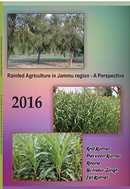
Rainfed Agriculture in Jammu region -A Perspective
₹ 300
ISBN Number : 978 - 1- 73034 - 201- 1
Book Overview
The Himalayan hill and mountain areas lying within India fall into two distinct
geographical regions with wide variation in climate, land use and culture. These are (i
North West Himalayan region comprising of the states of Jammu and Kashmir, Himachal
Pradesh and Uttaranchal. (ii) North East Himalayan region comprising the states of
Assam, Arunachal Pradesh, Manipur, Mizoram, Meghalaya, Nagaland, Tripura and
Sikkim and Siliguri-Darjeeling districts of West Bengal. North West Himalayan region
covers more than one eighth of the total land of the country and is located between 20o and
3oN latitude with elevations in the range of 300 to 8400 m above mean sea level. Some of
the areas at higher altitudes are sparsely populated.
The Jammu and Kashmir State lies in the extreme north of the Himalaya and constitutes
about 67.5 per cent of the North West Himalayan region. It extends between 32o-17' and
of 37o-5' North parallel of latitude and 73o-26' and 80o-30' east of meridians of longitudes
and 81o East of Greenwich. The State is located almost in the middle of three climatic
regimes of Asia. In its south border lies the weak monsoon zone of Punjab. On the northeast
the State is bordered by the vast arid plateau of Tibet while the North-west border
areas face the eastern limits of Mediterranean climatic region. This geographical
position, coupled with the varied Physiography provides the State a wide climatic
variation. The State has mostly a mountainous area and occupies a central position in the
continent of Asia. Out of 3.5 million ha of mountainous area of India, nearly two third i.e.
2.3 million ha are found exclusively in Jammu and Kashmir State. It has high
mountainous terrains with many snow covered peaks ranging in altitude from 554 to
7077m above mean sea level North and North-west, which are succeeded towards the
South by lower range of hills. Total geographical area of the State is 2, 22,236 km2 out of
which 78,114 km2 (35.15%) area lies under the occupation of Pakistan, and 42,735 km2
(19.23%) under the occupation of China (including the area handed over by Pakistan to
China). Therefore, the State is left with an area of 101,387 km2 (45.62%). Ladakh is the
largest hilly arid zone which occupies 58321 km2 (42.00%).


